The first thing our field crew unloads on a Central Coast NSW site is usually the triaxial geophone array—either a spread of 24 or 48 channels, coupled with a high-sensitivity digitizer running at 500 samples per second. The geology here rarely cooperates from the start: Hawkesbury Sandstone ridges drop into deep Quaternary alluvium within a few hundred metres, so sensor coupling changes three times before lunch. We combine active-source MASW with passive microtremor recordings because the ambient noise profile near the M1 and the railway corridor masks low-frequency Rayleigh waves, and without that dual approach the Vs30 estimate loses reliability below about 15 metres. For projects where the site class straddles the boundary between Class C and Class D under AS 1170.4, we often run a parallel CPT test to constrain the shallow shear-wave velocity profile against cone resistance, particularly in the soft estuarine clays that dominate the Tuggerah Lakes catchment. The result is a site period and amplification spectrum that ties back to real stratigraphy, not just a generic inversion model.
On the Central Coast, the same earthquake input can amplify by a factor of 3 to 4 between 0.8 and 2 Hz on the alluvial flats, while the sandstone ridges barely amplify at all.
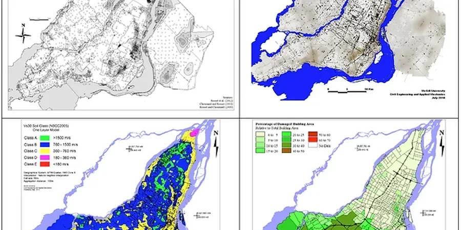
Technical details of the service in Central Coast NSW
Risks and considerations in Central Coast NSW
A four-storey mixed-use development we reviewed in the Wyong town centre illustrated the risk of skipping site-specific response analysis during the DA stage. The desktop study classified the site as Class C based on a regional geology map, and the structural engineer adopted the standard design spectrum from AS 1170.4. When we later completed a 24-channel active-passive survey across the footprint, the measured Vs30 came back at 210 m/s—solidly Class D—and the 1D equivalent-linear analysis showed a spectral acceleration plateau nearly 40 percent higher than the code default between 0.5 and 1.5 seconds. The footing design had to be reworked after tenders closed, which added six weeks and a contract variation that could have been avoided with a microzonation study during concept design. Across the Central Coast NSW, the most exposed sites are those on the Quaternary alluvium along the Wyong River and Ourimbah Creek corridors, where the sediment thickness exceeds 30 metres and the fundamental site period shifts into the resonant range of mid-rise buildings.
Our services
Our seismic microzonation work across the Central Coast NSW forms part of a broader geotechnical and geophysical capability that includes deep site characterization and foundation engineering. The reports we deliver integrate directly with the structural engineering workflow.
Site-Specific Ground Response Analysis
One-dimensional equivalent-linear and non-linear site response modelling using DEEPSOIL or Strata, calibrated against measured Vs profiles down to engineering bedrock. Outputs include surface acceleration time histories, response spectra at multiple damping ratios, and amplification factors for each borehole location across the site. The analysis accounts for the impedance contrast at the Hawkesbury Sandstone interface that controls amplification across the Central Coast NSW basin.
Vs30 Mapping and Site Classification Studies
Combined active-source MASW and passive microtremor array surveys across large development footprints, processed with spatial autocorrelation and frequency-wavenumber methods. Deliverables include contoured Vs30 maps, representative shear-wave velocity profiles per geotechnical unit, and AS 1170.4 site class delineation with GIS shapefiles for integration into architectural and structural models.
Top questions
What does a seismic microzonation study cost on the Central Coast NSW?
The fee range is AU$6,450 to AU$27,380 depending on the number of measurement points, the array aperture required, and whether passive microtremor recording supplements the active MASW survey. A single-point Vs30 classification with a short array sits at the lower end; a multi-hectare greenfield site requiring contoured Vs30 maps, ground response analysis, and site period mapping across variable geology will run toward the upper end. We scope every job against the AS 1170.4 site class boundary that affects the structural design loads.
How long does data acquisition take for a typical Central Coast site?
For a single measurement point using active MASW with a 46-metre spread, field acquisition takes about 90 minutes including setup, calibration, and three repeat shots per stack. If the scope includes passive microtremor recording—which we recommend for any site where the target investigation depth exceeds 20 metres—we add a 45-minute ambient noise window. A five-point survey across a typical residential subdivision in the Wyong or Tuggerah area can be completed in one long field day. Data processing and reporting add approximately two weeks.
How does the Central Coast geology affect seismic hazard differently from Sydney?
The Central Coast NSW sits on a thinner sedimentary cover over the Hawkesbury Sandstone compared to the Sydney Basin proper, but the Quaternary alluvial channels along the Wyong River and Tuggerah Lakes system create local pockets of deep, soft sediment that trap and amplify seismic energy. The site period in these pockets shifts toward 0.8–1.2 seconds, which overlaps with the fundamental period of 5- to 10-storey buildings. Sydney's deeper basin produces longer-period amplification that affects taller structures; the Central Coast hazard is concentrated in the mid-rise range, which makes AS 1170.4 site classification particularly sensitive to the Class C–Class D boundary.